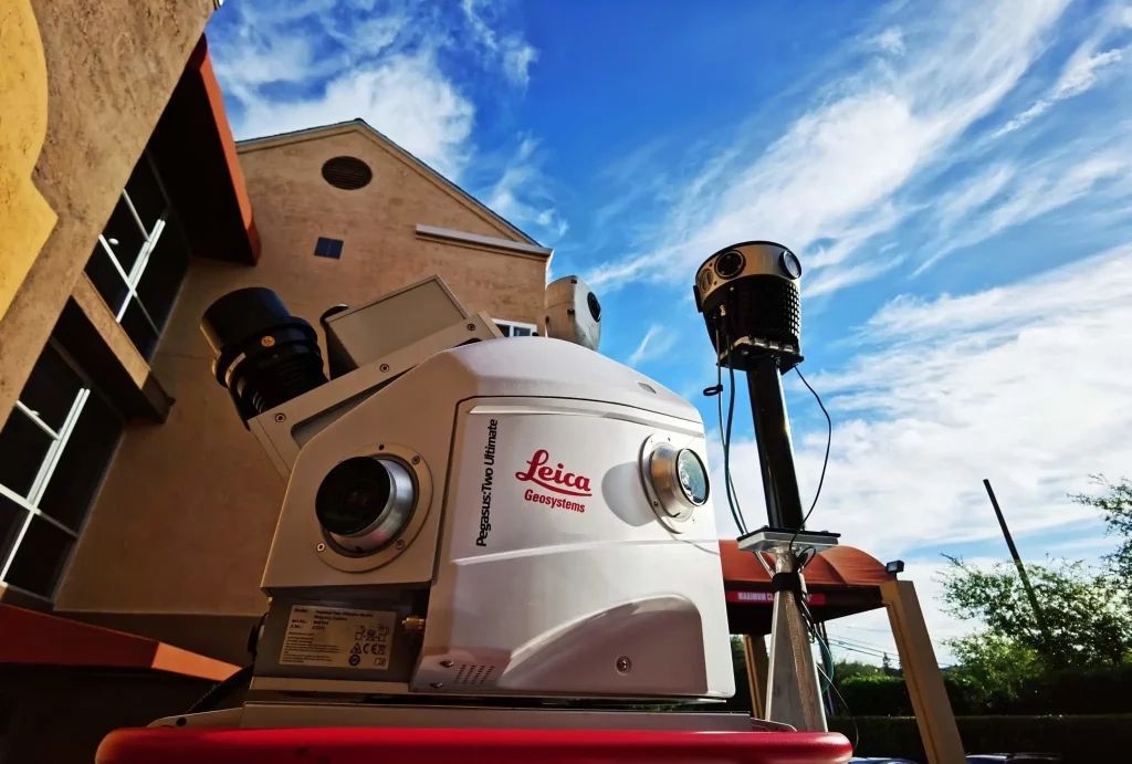

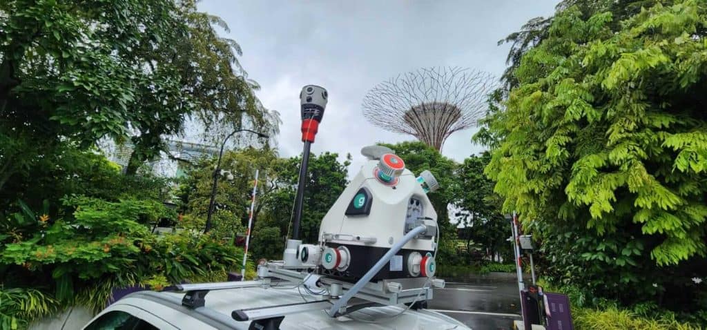
Mosaicカメラは、RIEGLレーザースキャナーと統合され同時に運用できます。
詳細説明
HD画像でマッピングの限界に挑む。Mosaic社の使命は、より良い世界観を構築することです。
360°イメージング技術とカメラ開発の分野で数十年の経験を持つMosaic社は、モバイルマッピングに特化したカメラシステムを製造する専門企業です。HDカメラを使用したモバイルマッピングサービスも提供しています。
Our customers

Netflix

Nira-app
Scanline VFX

Vistity

CoStar

Facebook

COWI

IntelliTest

Terratec

ViaTech

WGI

Citymagine
Cesium

Emlid
製品
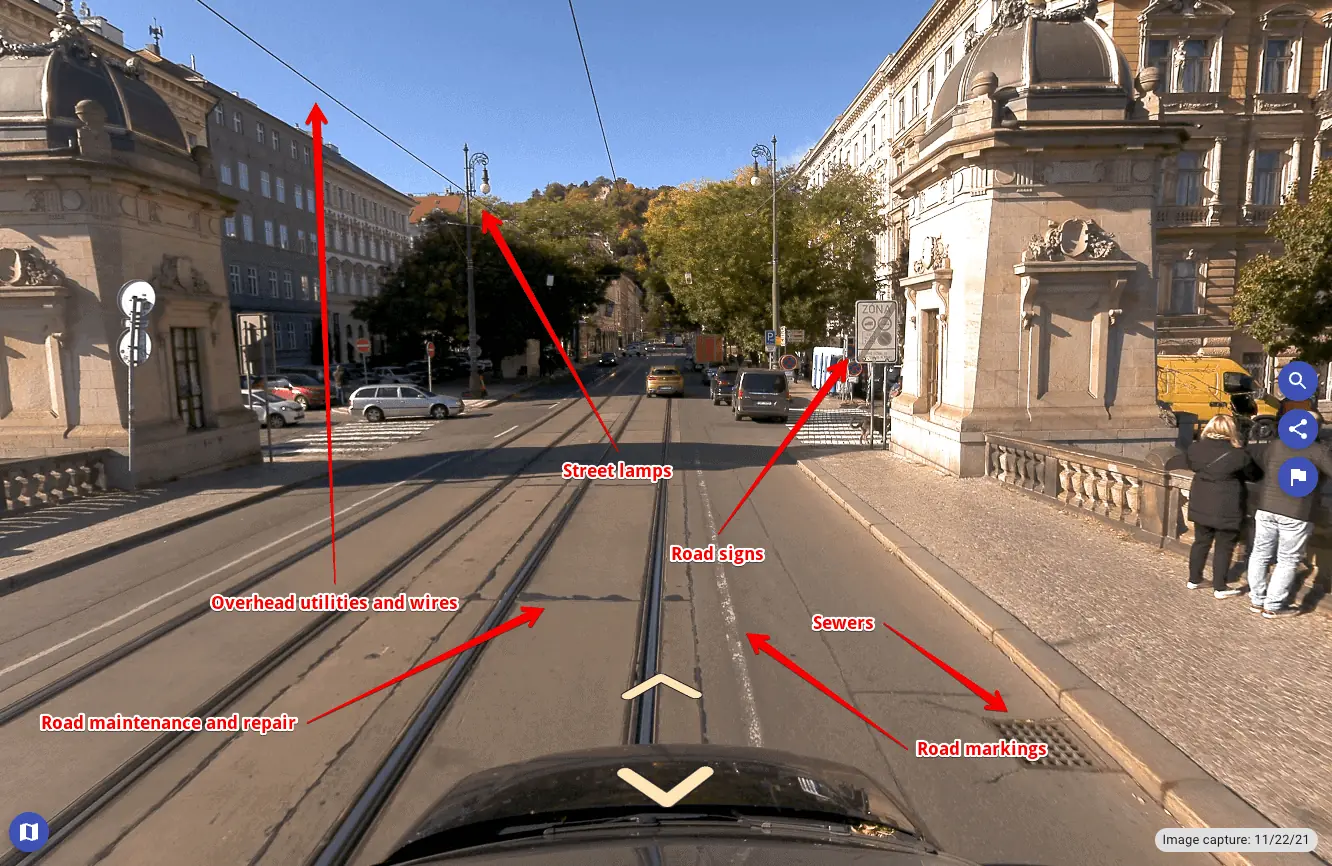
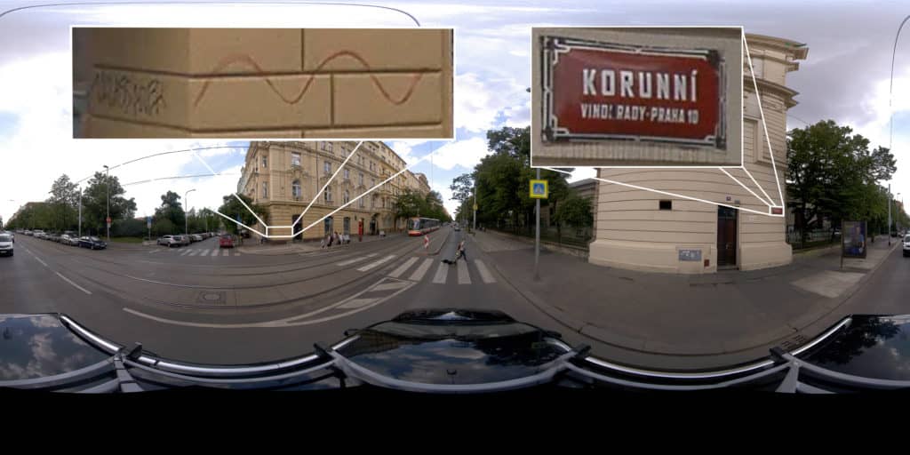
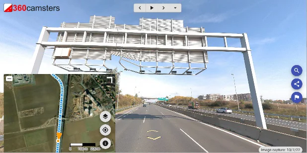
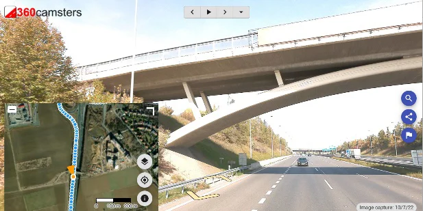
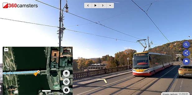
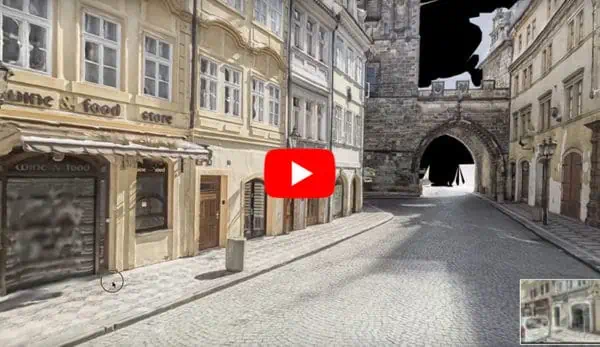
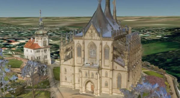
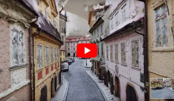
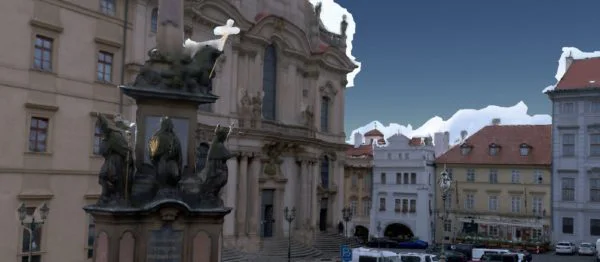
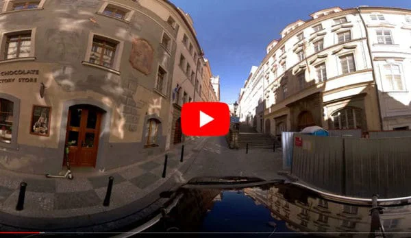
360°写真を「360°ビューア」で見ることができ、
拡大・縮小・移動が可能です。
ビューアは表示地図を含めユーザ使用の設定に変更できます。
Open the player full-size in a new window. Check out that bridge.
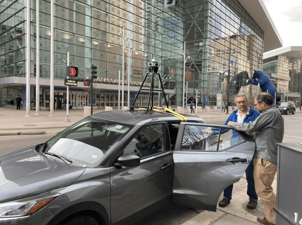
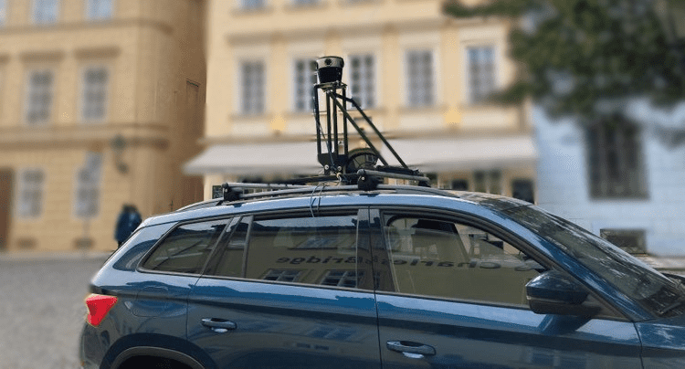
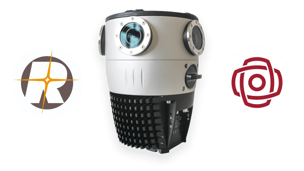
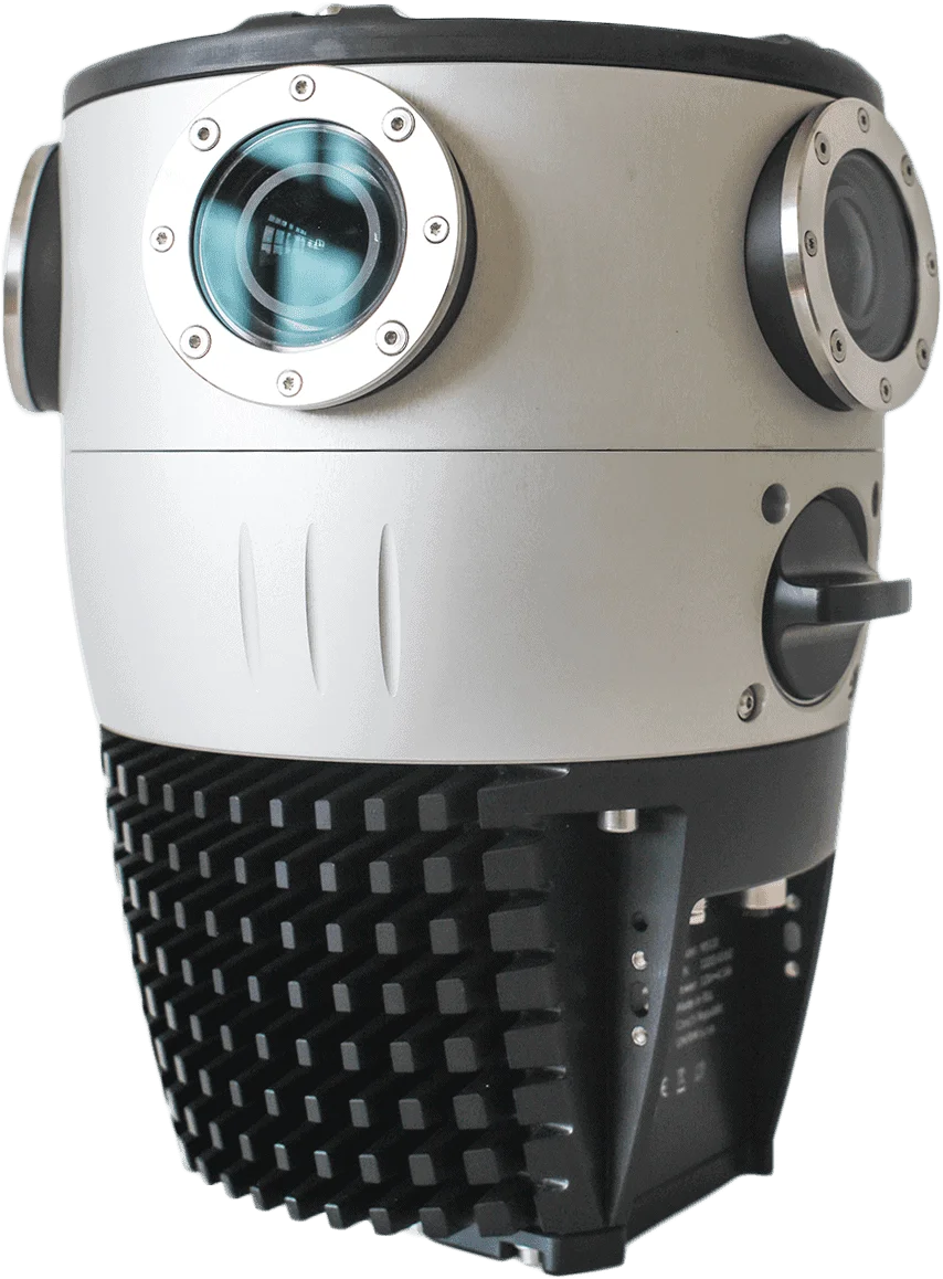
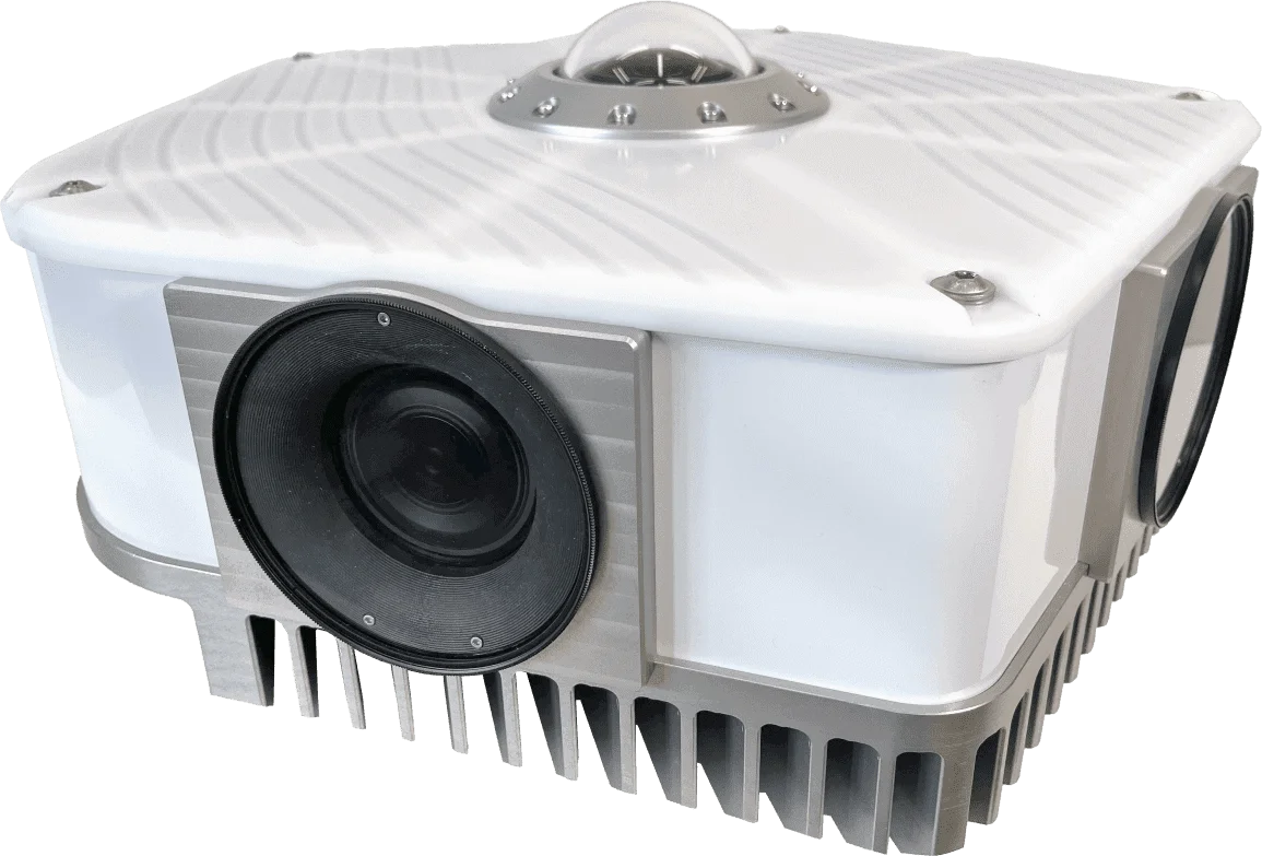
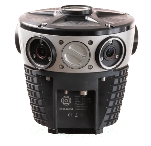
Mosaic 51 camera
12288 x 6144 pixel resolution. Open the player standalone.
12288 x 6144 pixel resolution. Open the player standalone.
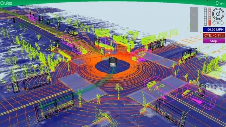
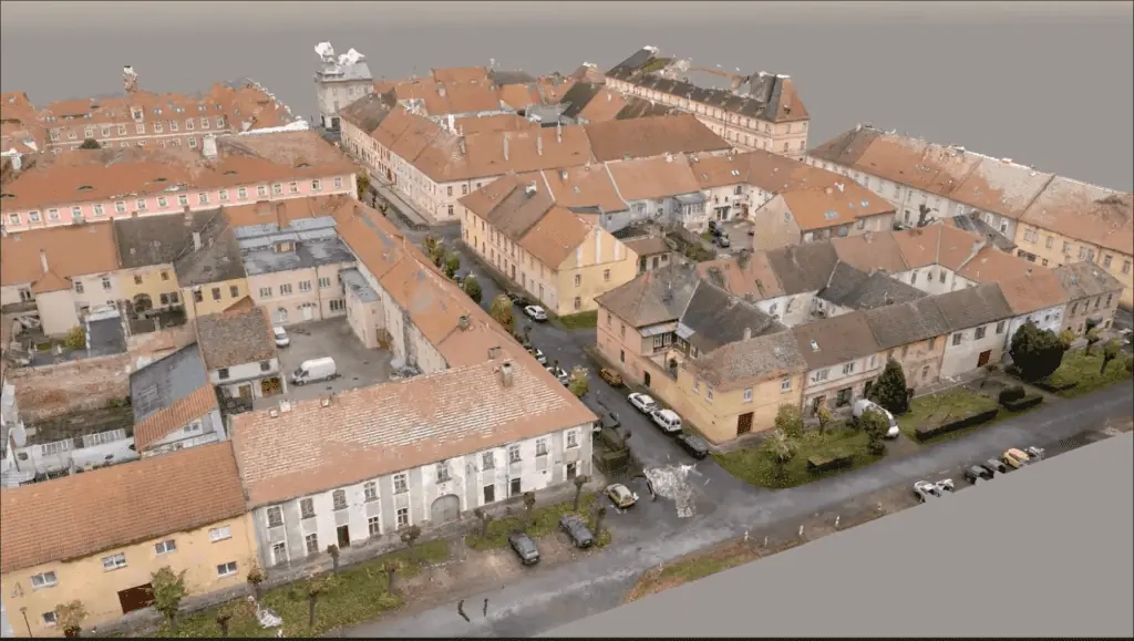
このビデオは、モデル Mosaic Xを搭載した自動車で48秒間走り作成した都市3Dモデルです。従来のMMSでレーザー(ライダー)が必須でしたが、写真から高密度の点群データを取得できます。Mosaic Xは小型のため狭い路地でも走行できます。

Mosaicカメラの特長:
HDモードで3Dスキャンし都市モデルを構築する
- これまでにない12K、13K、22K解像度の写真から3Dシティマッピングを実現する
- 大規模なエリアを数時間や数日ではなく、数分でスキャンを完了する
- LiDARを使わずに、高解像度の画像を取得して鮮明な3Dモデルを構築する

Discover what Mosiac customers are so excited about
GIS/GPS Technician II
Buying this camera was one of the easiest decisions I’ve ever made. On every single metric, the Mosaic 51 beat out its competitors: its image quality is the best…the powerful script to stitch saves us enormous amounts of processing time… comes in seamlessly to our ESRI software.

Head of Delivery
Our approach with your camera [the Mosaic 51], absolute winner. There isn’t any part of the process where we’ve felt that we’re going backwards…We were able to move the price point of individuals down somewhere in the region of 40%…That’s enabled us to stay competitive.
Sr. Technology Specialist / KBW Investments
We knew from the start that we wouldn’t go wrong with our choice of the Mosaic 51 and it has proven to be the best in the market. We have been successfully scanning the whole country for several months, focusing on identifying utilities, thus adding increased automation to a once manually-intensive project. Our ultimate goal is to turn all cities in Jordan into smart cities. With the added benefit of being able to integrate with external sensors, including the Emlid RS2 RTK, the benefits and applications are amazing. We will always keep a close eye on Mosaic products as they always amaze us with new features and capabilities.
Technical Manager at Field
We were also looking for a camera with MUCH higher resolution that could be a killer in the market.
In the Nordic region, the customers are very focused on resolution, so to compete with that, you need the Viking.
We can acquire more customers because we have a ‘better system and can compete with our competitors.
In the Nordic region, the customers are very focused on resolution, so to compete with that, you need the Viking.
We can acquire more customers because we have a ‘better system and can compete with our competitors.
CEO
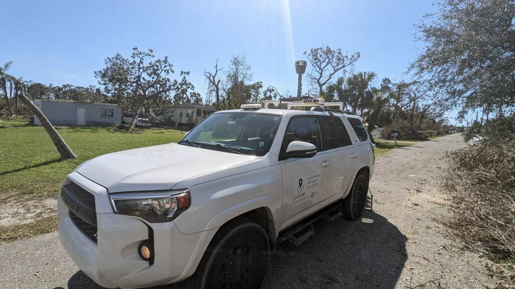
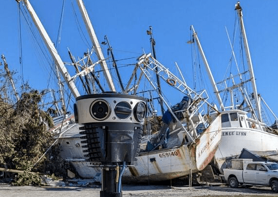
Hurricane Ian (near category 5 hurricane) came ashore in Ft Myers, FL. We deployed the newly purchased Mosaic 51 camera to the scene immediately. It performed quite well while collecting over 400 miles of 360 imagery in very harsh conditions!

Mobile sensor specialists
Yours can be sent into orbit!
(referring to the robustness of the Mosaic 51)
(referring to the robustness of the Mosaic 51)

New Cutting-Edge 72 Megapixel Spherical Mosaic Camera System is one of the best 360º camera setups on the market today. it provides 72 MP of high-resolution imagery & allows us to offer a more robust dataset to our teams, clients and performs on-the-fly image optimization (brightness, contrast, color balance).
Recognized as the 2021 Water Monitoring Solution of the Year by AgTech Breakthrough Awards within the category of In-Field Systems for the innovative method of data capture for efficient and environmental friendly water management.
...are extremely robust, the highest-resolution cameras on the market, and the most mobile due to an onboard GPU. With this technology, agencies and communities can maintain updated maps and compare them with previous data to more accurately predict where there are potential risks involved in future vegetation growth or proximity to utility lines.
Fresh insights
Featured
Industry