
最高の解像度で
データを取得する
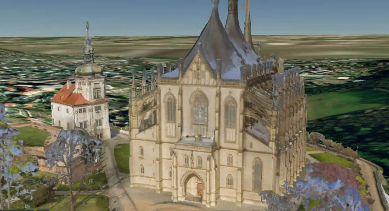
22Kの高解像度は細部まで鮮明に捉え、高品質のデータを提供する
- 都市や国全体を超高画質で3D地図化する
- LiDARを使わずに数分で高品質の点群データを作成可能
- 大規模なエリアで詳細な資産を3Dモデル化する
Mosaic Vikingで得られるものは?

すばやくプロジェクトを完了する
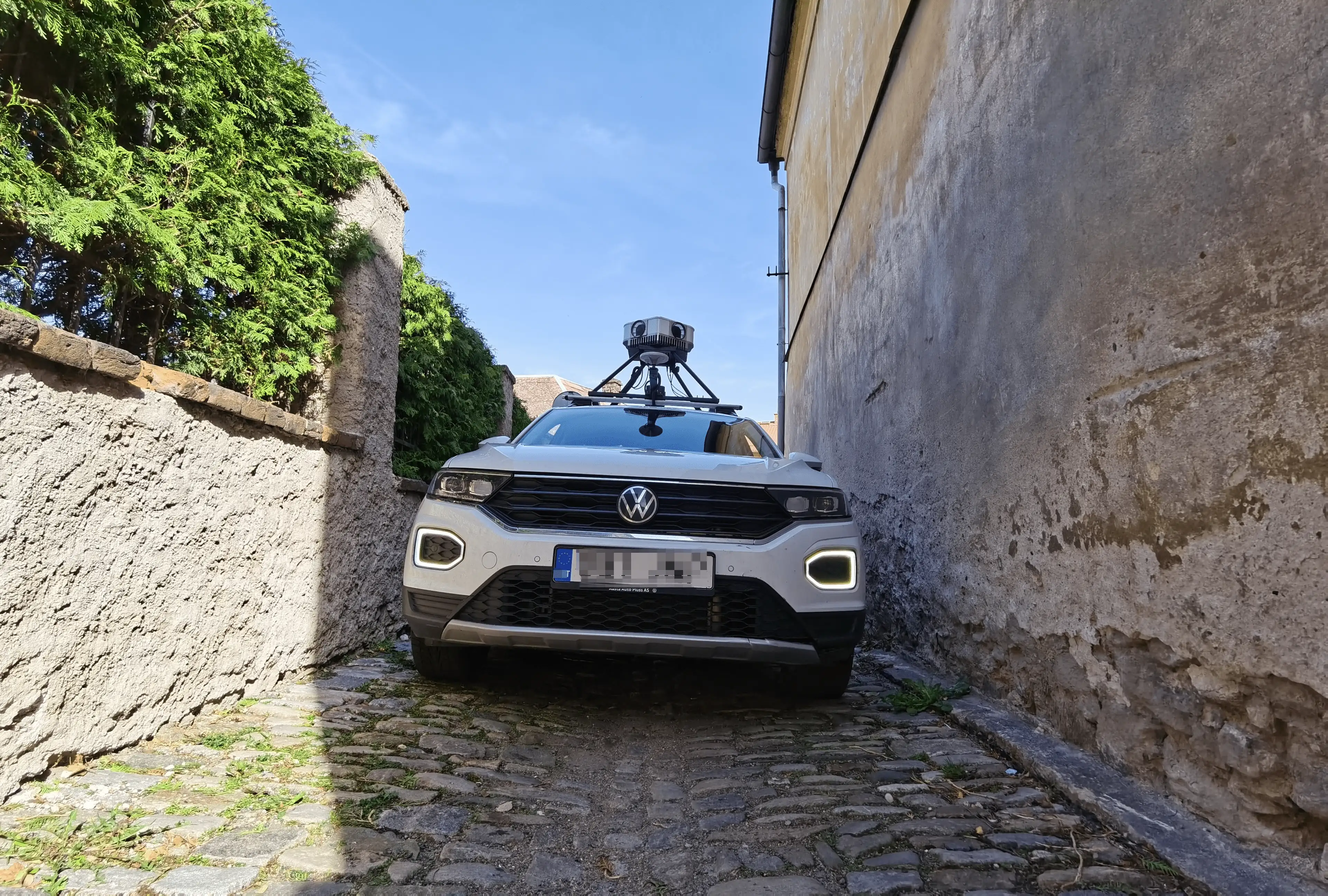
市街地走行で1回通過するだけで、22Kの解像度の3Dモデルを作成できる

日常的なコストの削減
ドライバー1人でデータを短時間で収集可能

高品質のデータを取得
最高品質のカメラでなければ得られない映像で、180MPのクリスタルクリアな画像を取得する
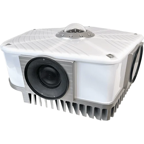
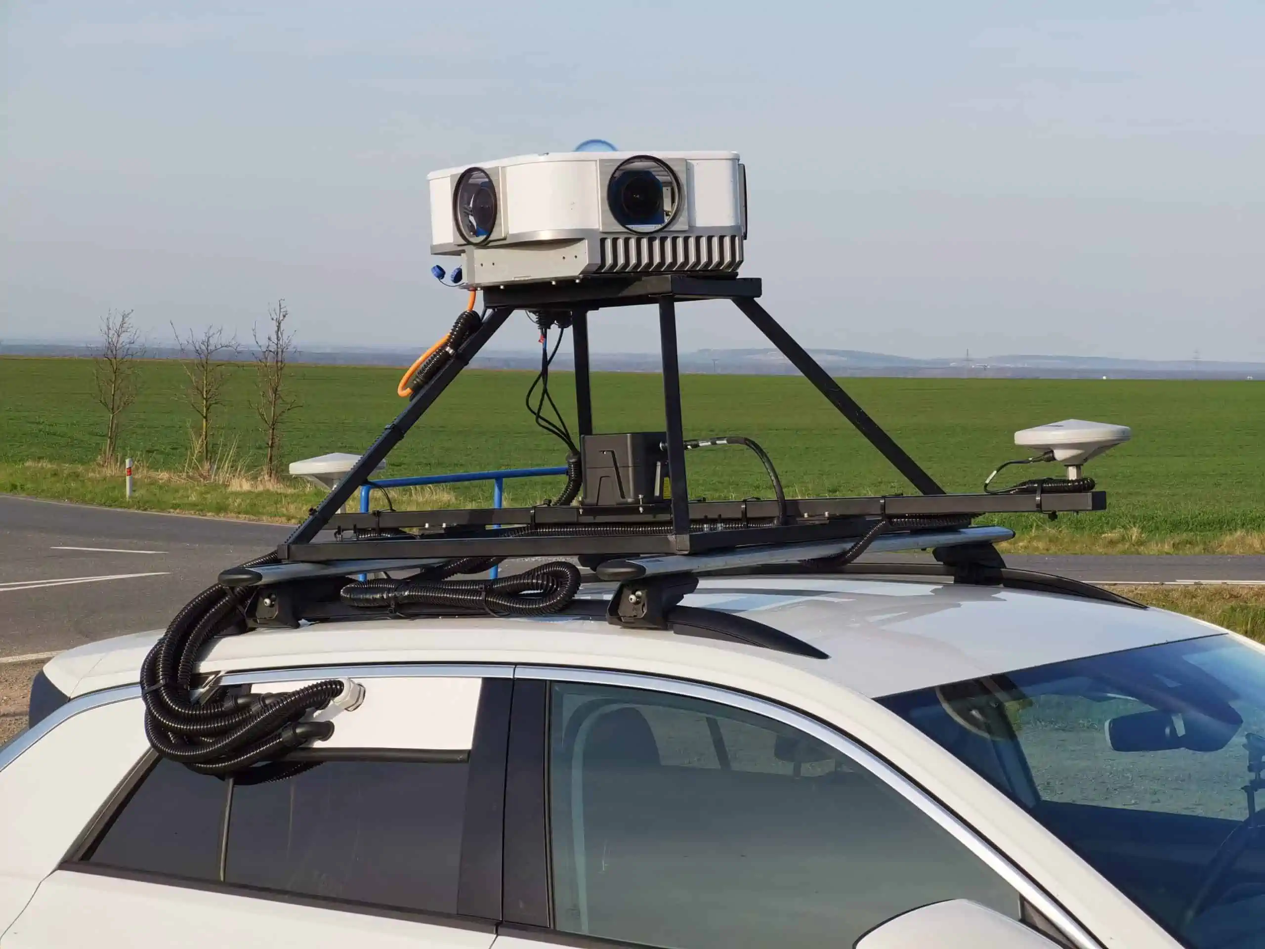
Mosaic Vikingの革新的な特徴


プロジェクトに特化した洗練された技術

3D地図作成・会社
道路やインフラなどのデータをピクセル精度で取得し、精細感や色彩のクオリティを維持する

VFX & ビデオゲームスタジオ
従来の方法と比べ、計測時間は大幅に削減でき、実物に近い3Dアセットをモデル化できる

市町村、自治体
市町村、都市の実物大のデジタルツインを構築できる
地理空間情報の専門員が語るMosaic Vikingの魅力
Technical Manager at Field
We were also looking for a camera with MUCH higher resolution that could be a killer in the market.
In the Nordic region, the customers are very focused on resolution, so to compete with that, you need the Viking.
We can acquire more customers because we have a better system and can compete with our competitors.
In the Nordic region, the customers are very focused on resolution, so to compete with that, you need the Viking.
We can acquire more customers because we have a better system and can compete with our competitors.
Mosaic Vikingで高画像写真を取得する
360°ビデオを作成する、または構築した3Dモデルから360°動画を作成する
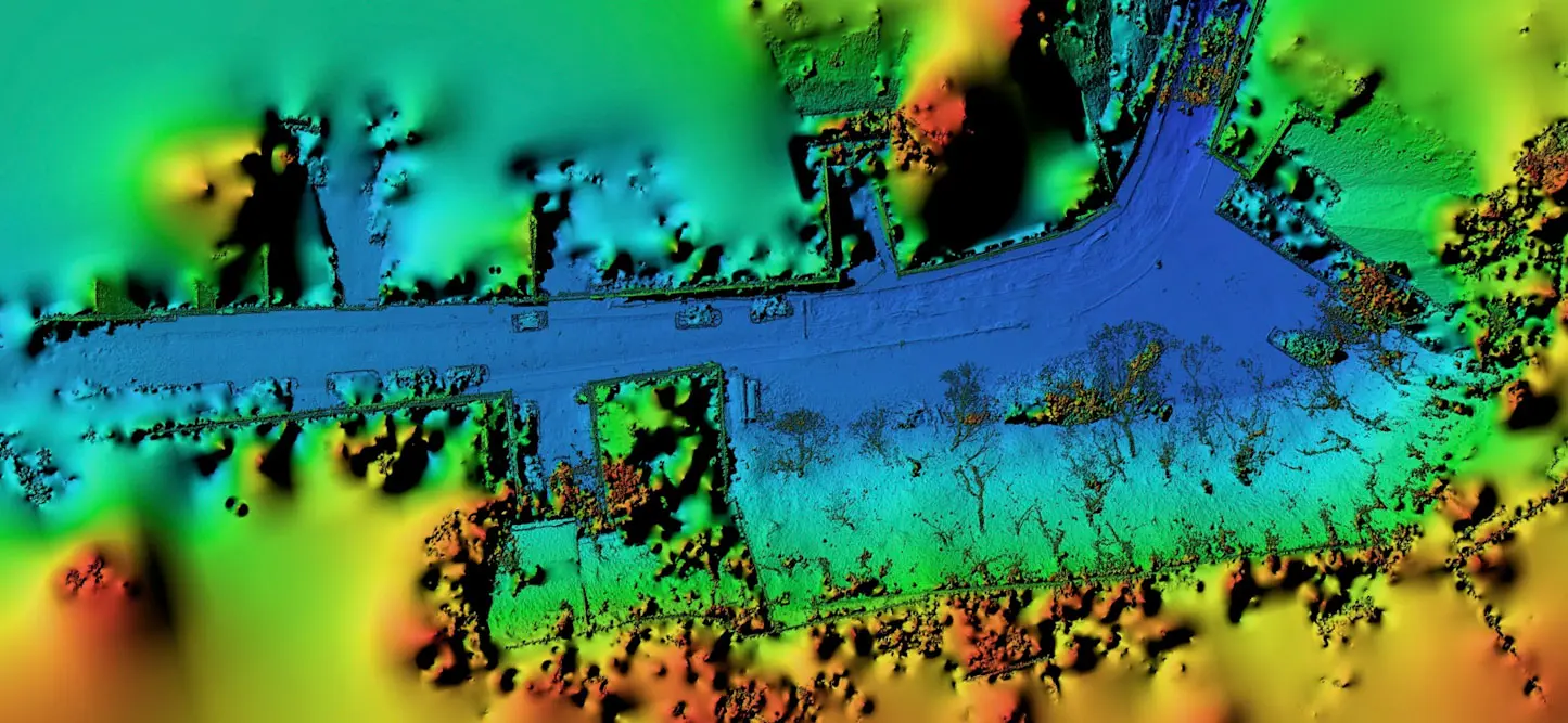
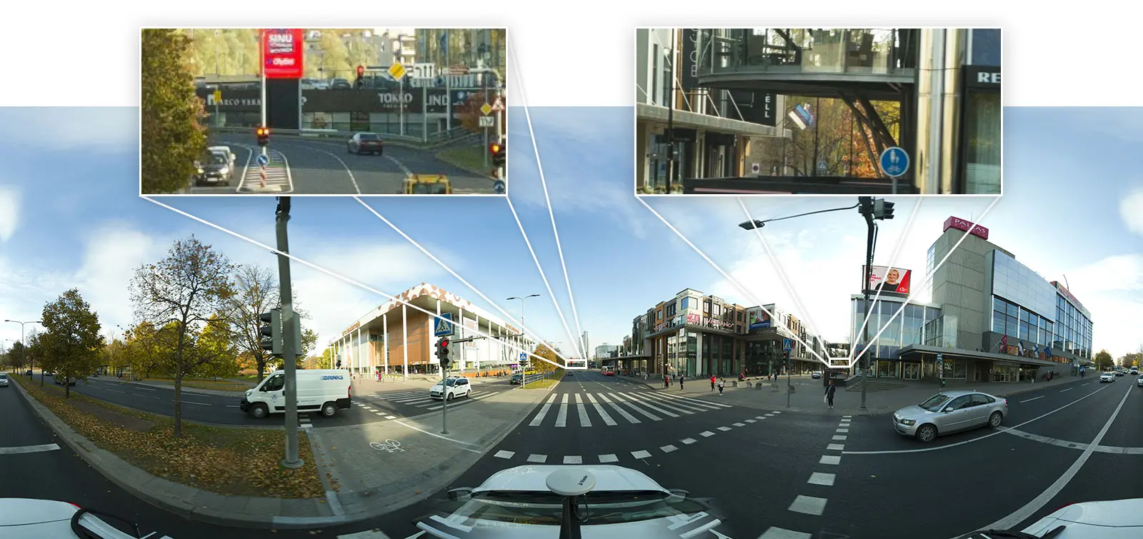
Full 360° Panorama Image Generated with Mosaic Viking Image Data
22K解像度のパノラマ画像を生成する
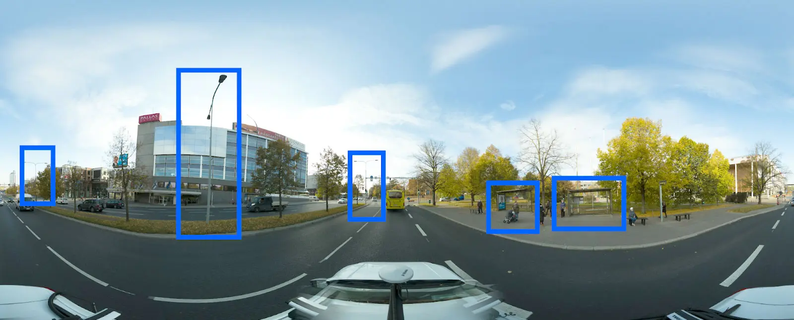
AIと連携して物体検出を行う
デジタル標高マップの作成